
Summary ![]()
| Difficulty | 3 Intermediate |
| Length | 7.5 miles one-way to Burst Rock Junction or 15.0 miles round trip |
| Starting Elevation |
6400 feet |
| Cumulative Elevation Change |
+1900, -150 feet one-way to Burst Rock Junction or +2050, -2050 feet round trip |
| Navigation | Road, marked trail and map |
| Time | Full day |
| Season | December through mid-April |
| Snowmobiles Use | Not permitted [Please report illegal use of snowmobiles in this area.] |
| USGS Topo | 7.5' series, Pinecrest |
| Start | Dodge Ridge Ski Resort parking loop. Follow Dodge Ridge Road to where the one-way loop of the ski area parking lot begins. A right turn at this point leads into the parking area at the Crabtree Trailhead. |
Description ![]()
The Crabtree Road tour to Burst Rock Junction is the longest of the three tours described in this guide to Burst Rock Junction. The shortest is the Gooseberry Road tour and the other is the Old Crabtree Road tour. The Crabtree Road and the Old Crabtree Road tours start at the same point thus no shuttle is necessary if you combine them into a loop. Using Gooseberry Road for one direction of a loop entails a short shuttle.
Regardless of which route or routes you ski to and from Burst Rock Junction, the tour to it is long.
Crabtree Road is wide and easy to follow; all you have to do is stay on the main road at a few junctions. But to reach Burst Rock Junction as described, you must leave the road and ski cross country for 0.2 mile and the point at which you must leave the road is not clearly marked. If you miss that point you continue east toward the site of Gianelli Cabin. Actually, you can reach Burst Rock Junction via the site of Gianelli Cabin but it adds an additional 3.3 miles one-way. This alternative is described in the mileage log.
In contrast, the 0.2 mile cross-country section is fairly easy to locate if you ski this tour in the reverse direction, i.e. back from Burst Rock Junction.
Mileage Log ![]()
Numbers in parentheses
correspond to mileage points on map
Note: The Pinecrest Nordic Ski Patrol has marked many backcountry ski trails in this area. Where applicable, the numbers and name of the trails are given in brackets. Visit their website to download a map showing all the marked trails or obtain a map at the Summit Ranger District office at #1 Pinecrest Lake Road near the junction with Highway 108.
Waypoint 1 to 3
Miles: 0.0 - 0.4
Elevation change: -50 feet
From the trailhead (1) ski on the spur road that weaves southwest for 0.4 mile until you reach the intersection with Crabtree Road (3). You may or may not see the road junction at mileage point 2, which is located 0.1 mile from Crabtree Road. The road that intersects the spur road you are on enters from the east (left), is part of a series of roads that lead to the ski resort, and is sometimes groomed. You will know you are at Crabtree Road because a stop sign and road direction sign will probably be visible.
Waypoint 3 to 5
Miles: 0.4 - 1.6
Elevation change: +550 feet
Turn southeast (left) onto Crabtree Road and ski in that direction for 0.9 mile and then north for 0.3 mile until you reach Hair Pin (5) an almost 180-degree turn in the road. You may or may not see the road junction at mileage point 4, which is located 0.4 mile from the previous road junction. The junction at mileage point 4 is a Y with the north-most (left) fork heading downhill and is part of a series of roads that lead to the ski resort. It is sometimes groomed. This tour stays on the larger, south-most (right) fork. [#5 Aspen Meadow trail]
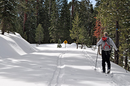
 Crabtree Road
Waypoint 5 to 6
Miles: 1.6 - 2.1
Elevation change: +150 feet
Continue climbing south on Crabtree Road for 0.5 mile until you reach a road junction (6). The road makes a left turn just before you reach the junction. [#5 Aspen Meadow trail]
 Crabtree Road near road junction at mileage point 6
You can make an interesting short detour from the road junction by skiing west, at first through trees and then in the open, for 0.1 mile until you reach the top of a ridge from which there is an expansive view to the north and west.
Waypoint 6 to 7
Miles: 2.1 - 2.2
Elevation change: Nil
Continue east (straight) on Crabtree Road for 0.1 mile until you reach a pack station and Aspen Meadow (7). [#5 Aspen Meadow trail]
 Aspen Meadow
Waypoint 7 to 8
Miles: 2.2 - 3.0
Elevation change: +250 feet
Continue skiing slightly north of east on Crabtree Road for 0.8 mile until you reach a road junction (8). Old Crabtree Road continues slightly north of east (straight) and eventually goes to The Knob. The Crabtree Road tour continues on the road to the southwest (right). [#5 Aspen Meadow trail]
Waypoint 8 to 9
Miles: 3.0 - 3.4
Elevation change: +150 feet
Turn southwest and follow Crabtree Road for 0.4 mile until you reach a sharp turn in the road to the east (left) on a ridgetop (9). [#7 Strider II trail]
Waypoint 9 to 10
Miles: 3.4 - 4.8
Elevation change: -50 feet
Ski east on the road for 1.4 miles until you reach a road junction (10). The road to the south goes to the summer Crabtree trailhead. [#7 Strider II trail]
Waypoint 10 to 11
Miles: 4.8 - 5.4
Elevation change: +50, -50 feet
Continue slightly north of east on the main road (straight) for 0.6 mile until you reach a 180-degree turn in the road (11). The turn is called "Duck Bill" due to the shape the road makes on the map. [#7 Strider II trail]
Waypoint 11 to 12
Miles: 5.4 - 7.3
Elevation change: +700 feet
Continue on the road in a meandering loop at first generally to the west, then north and finally northeast for a total of 1.9 miles until you reach the most northern section of this portion of Crabtree Road and the point where the marked trail leaves the road (12). Unfortunately this point is poorly marked. The best way to locate where the trail leaves the road is with a GPS but short of that continually look over your shoulder until you see a clearing through the trees that leads up and to the west. [#7 Strider II trail]
Waypoint 12 to 16
Miles: 7.3 - 7.5
Elevation change: +50 feet
Leave Crabtree Road and ski west through a clear path for 0.2 mile until you reach Old Crabtree Road (16). [#7 Strider II trail]
Waypoint 16 to 17
Miles: 7.5 - 7.5
Elevation change: Nil
Turn west onto Old Crabtree Road and follow it for 100 yards until you reach Burst Rock Junction (17). The junction is well marked with multiple signs on a large tree. [#7 Strider II trail]
Return to trailhead
Miles: 7.5 - 15.0
Elevation change: +150, -1900 feet
Retrace the route for 7.5 miles back to the trailhead (1) or return to Dodge Ridge ski area by the Old Crabtree Road tour or the Gooseberry Road tour.
Extension via Gianelli Cabin site
You can add 3.3 miles one-way to Burst Rock Junction and +550, -550 feet of elevation change by continuing to the east beyond mileage point 12 on Crabtree Road.
Waypoint 12 to 13
Miles: 7.3 - 8.9
Elevation change: +500 feet
Continue southeast, then northeast and finally east for a total of 1.6 miles until you reach the general area of the Gianelli Cabin site and the point where the road loops to the northwest (13). Here Crabtree Road becomes Old Crabtree Road and noticeably narrows.
Waypoint 13 to 14
Miles: 8.9 - 9.3
Elevation change: +100, -50 feet
Continue on the narrower road for 0.4 mile until you reach the ridgetop (14). The route to Burst Rock follows the ridge to the northeast.
Waypoint 14 to 15
Miles: 9.3 - 9.6
Elevation change: -100 feet
Continue southwest on the ridge and road for 0.3 mile until you reach a road junction (15). Don't be surprised if you don't see the junction.
Waypoint 15 to 16
Miles: 9.6 - 10.6
Elevation change: -400 feet
Continue southwest and then west on the road for a total of 1.0 mile until you reach the point where the Strider II trail intersects Old Crabtree Road (16). Don't be surprised if you don't see this junction; it is only another 100 yards to Burst Rock Junction.
Waypoint 16 to 17
Miles: 10.6 - 10.6
Elevation change: Nil
Continue west on Old Crabtree Road for 100 yards until you reach Burst Rock Junction (17). The junction is well marked with multiple signs on a large tree. [#7 Strider II trail]
Return to trailhead
Miles: 10.6 - 21.2
Elevation change: +700, -2450 feet
Retrace the route for 10.6 miles back to the trailhead (1) or return to Dodge Ridge ski area by the Old Crabtree Road tour or the Gooseberry Road tour.
