
Summary ![]()
| Difficulty | 3 Intermediate |
| Length | 4.0 miles round trip |
| Starting Elevation |
7050 feet |
| Cumulative Elevation Change |
+750, -750 feet |
| Navigation | Road and marked trail |
| Time | Half day |
| Season | December through mid-April |
| Snowmobiles Use | Low |
| USGS Topo | 7.5' series, Bear River Reservoir |
| Start | Junction of Highway 88 and Foster Meadow Road, 0.8 mile east of Peddler Hill Maintenance Station and 11.1 miles west of the Silver Lake dam. Parking is on the north side of the highway in a cut-out that only holds 4 to 6 vehicles. Park carefully to maximize capacity. |
Description ![]()
The Trail Junction Via the Ridge tour is one of two tours that connect the trailhead at Foster Meadow Road with Trail Junction. It is suitable for intermediate skiers while the Trail Junction Via the Road tour is suitable for beginners.
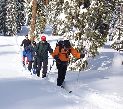
Fresh powder on ridge to Trail Junction
The difficulty along the ridge is created by the steepness of the terrain combined with lots of trees. The markers weave in-and-out of the trees and are difficult to follow without careful attention, but you will be okay so long as you stay on or near the ridgetop.
The ridge and road tours intersect at Trail Junction and at a mid-point thus making short and long loops possible by combining them.
Trail Junction is significant because it is the hub for four trails:
Trail Junction Via the Road
Trail Junction Via the Ridge
Cosumnes Loop
Anderson Ridge
These trails and others can be viewed on the same map in the Foster Meadow Road and Mormon Emigrant Trail Area tour.
Mileage Log ![]()
Numbers in parentheses
correspond to mileage points on map
Waypoint 1 to 2
Miles: 0.0 - 0.1
Elevation change: +100
From the trailhead (1) follow the markers up the slope to the east for 0.1 mile until you reach a snow-covered road (2).
Waypoint 2 to 3
Miles: 0.2 - 0.2 [approx. 100 feet]
Elevation change: Nil
Turn east (right) onto the road and ski approximately 100 feet until you reach the turnoff for the "ridge" (3). Signs mark this location.
Waypoint 3 to 4
Miles: 0.2 - 1.3
Elevation change: +200, -100
Leave the road and follow the markers and ridge generally north (left) for 1.1 miles until you reach a saddle (4). This section is a steady climb to a high point followed by a descent to the saddle and the intersection with the road tour.
Waypoint 4 to 5
Miles: 1.3 - 1.7
Elevation change: +200
Continue skiing along the ridge to the northeast for 0.4 mile until you reach the north end of a high point (5). From this point you have a wonderful view to the red cliffs of Thunder Mountain.
Waypoint 5 to 6
Miles: 1.7 - 2.0
Elevation change: -150
Descend the steep slope to the north and then continue north for a total of 0.3 mile until you reach Trail Junction (6), which is located at a saddle. Do not be tempted to descend to the northeast.
Return to trailhead
Miles: 2.0 - 4.0
Elevation change: +250, -500 feet
Retrace the route for 2.0 miles back to the trailhead (1).
