
Summary ![]()
| Difficulty | 4 Intermediate-advanced |
| Length | 6.0 miles round trip |
| Starting Elevation |
7200 feet |
| Cumulative Elevation Change |
+1900, -1900 round trip |
| Navigation | Road, marked trail and map |
| Time | Most of a day |
| Season | December through mid-April |
| Snowmobiles Use | Not permitted except between mileage points 1 and 2. [Please report illegal use of snowmobiles in this area.] |
| USGS Topo | 7.5' series, Norden |
| Start | The plowed loading zone on the north side of Interstate 80 at the Castle Peak Area and Boreal Ridge exit. Parking is at the Donner Pass Sno-Park located at the east end of the frontage road on the south side of the interstate at the same exit. |
Description ![]()
Viewed from the south, it is clear why Castle Peak was named. A massive fortress, Castle Peak stands alone (except for Basin Peak) commanding an awe inspiring view.
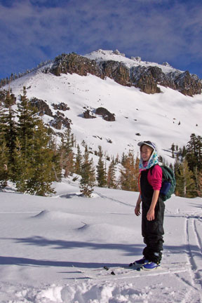
Castle Peak from Castle Pass
The summit has long been a destination for skiers in the Donner Pass area. The scenery from the summit is outrageous — beyond the Donner Summit area you can see north to Sierra Buttes and south to the peaks of Desolation Valley. In addition to the scenery, the bowl to the northeast of the summit attracts telemark skiers. Be aware that this bowl and many of the slopes in the vicinity of Castle Peak are unsafe when unstable snow conditions prevail.
The tour to the summit of Castle Peak is a combination of two distinct parts. First there is the modest climb to Castle Pass and then there is the steep ascent to the peak (1200 feet in 1.2 miles).
Castle Peak is one of several popular destinations for those spending a night or two at nearby Peter Grubb Hut.
Mileage Log ![]()
Numbers in parentheses
correspond to mileage points on map
Waypoint 1 to 2
Miles: 0.0 - 0.3
Elevation change: +100 feet
From the trailhead (1) ski east on the snow-covered road that parallels the interstate and then northwest for a total of 0.3 mile until you reach a road junction (2). The tour continues northwest (straight) on the road while the road to the west (left) loops around the west side of Andesite Ridge.
Waypoint 2 to 3
Miles: 0.3 - 0.5
Elevation change: Nil
Ski northwest (straight) on the road for 0.2 mile until you reach the edge of the meadow (3) in Castle Valley.
Waypoint 3 to 4
Miles: 0.5 - 1.7
Elevation change: +500 feet
Ski northwest on the road, which may be difficult to discern, for 1.2 miles until you reach the flat area (4) at the base of Castle Pass.
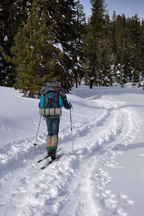
Heading to Castle Pass
Waypoint 4 to 5
Miles: 1.7 - 1.8
Elevation change: +100 feet
Ascend to the northwest for 0.1 mile until you reach Castle Pass (5). This section is very steep.
Waypoint 5 to 6
Miles: 1.8 - 2.3
Elevation change: +400 feet
Climb northeast for 0.5 mile until you reach the ridge (6) that leads to the summit of Castle Peak.
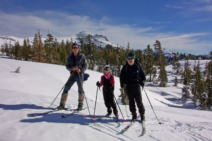
Ridge you ascend to Castle Peak runs from right to left in background
Waypoint 6 to 7
Miles: 2.3 - 3.0
Elevation change: +800 feet
Climb east on the ridge for 0.7 mile until you reach the summit of Castle Peak (7).
Return to trailhead
Miles: 3.0 - 6.0
Elevation change: -1900 feet
Retrace the route for 3.0 miles back to the trailhead (1).
