
Summary ![]()
| Difficulty | 3 Intermediate |
| Length | 5.2 miles round trip |
| Starting Elevation |
7200 feet |
| Cumulative Elevation Change |
+1000, -1000 round trip |
| Navigation | Road, marked trail and map |
| Time | Half day |
| Season | December through mid-April |
| Snowmobiles Use | Not permitted except between mileage points 1 and 2. [Please report illegal use of snowmobiles in this area.] |
| USGS Topo | 7.5' series, Norden |
| Start | The plowed loading zone on the north side of Interstate 80 at the Castle Peak Area and Boreal Ridge exit. Parking is at the Donner Pass Sno-Park located at the east end of the frontage road on the south side of the interstate at the same exit. |
Description ![]()
Peter Grubb Hut, built by the Sierra Club in the thirties, is a popular destination for ski tourers. Located in beautiful Round Valley, the hut is often used to make the 5.2-mile round trip tour into an overnight tour.
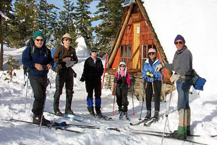
Peter Grubb Hut
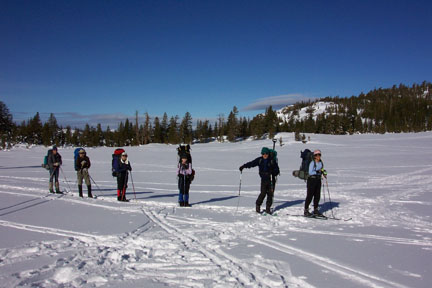
Nearby Castle Peak, Basin Peak, and the ridge between the two peaks are popular destinations for those with sufficient time and skills. The less adventuresome can visit Sand Ridge and/or Sand Ridge Lake.

North of Basin Peak

Exploring flanks of Basin Peak
Make reservations to stay overnight at this Sierra Club hut by contacting:
Clair Tappaan Lodge
P.O. Box 36
Norden, CA 95724
530-426-3632 (phone)
800-679-6775 (toll free)
530-426-0742 (fax)
ctl@sierraclub.org
You do not have to be a member of the Sierra Club to use this hut. As one might expect, however, reservations for weekends and holidays are difficult to obtain. Volunteer for a summer or fall work party at one of the Sierra Club's huts to get reservation priority (contact Clair Tappaan Lodge for more information).
Mileage Log ![]()
Numbers in parentheses
correspond to mileage points on map
Waypoint 1 to 2
Miles: 0.0 - 0.3
Elevation change: +100 feet
From the trailhead (1) ski east on the snow-covered road that parallels the interstate and then northwest for a total of 0.3 mile until you reach a road junction (2). The tour continues northwest (straight) on the road while the road to the west (left) loops around the west side of Andesite Ridge.
Waypoint 2 to 3
Miles: 0.3 - 0.5
Elevation change: Nil
Ski northwest (straight) on the road for 0.2 mile until you reach the edge of the meadow (3) in Castle Valley.
Waypoint 3 to 4
Miles: 0.5 - 1.7
Elevation change: +500 feet
Ski northwest on the road, which may be difficult to discern, for 1.2 miles until you reach the flat area (4) at the base of Castle Pass.

Skiing toward Castle Pass
Waypoint 4 to 5
Miles: 1.7 - 1.8
Elevation change: +100 feet
Ascend to the northwest for 0.1 mile until you reach Castle Pass (5). This section is very steep.

View west from Castle Pass
Waypoint 5 to 6
Miles: 1.8 - 2.6
Elevation change: +100, -200 feet
Ski north while traversing the west ridge of Castle Peak for 0.6 mile and then descend for 0.2 mile until you reach Round Valley and Peter Grubb Hut (6). Do not be tempted to descend directly from Castle Pass; you will be heading in the wrong direction and will end up losing too much elevation. In very heavy winters, most or even all of Peter Grubb Hut is covered by snow.

Traversing toward Round Valley in storm
Round Valley
Return to trailhead
Miles: 2.6 - 5.2
Elevation change: +200, -800 feet
Retrace the route for 2.6 miles back to the trailhead (1).
