
Summary ![]()
| Difficulty | 2 Beginner-intermediate |
| Length | 2.8 miles round trip |
| Starting Elevation |
7050 feet |
| Cumulative Elevation Change |
+250, -250 round trip |
| Navigation | Map |
| Time | Several hours |
| Season | Late December through mid-April |
| Snowmobiles Use | Low |
| USGS Topo | 7.5' series, Norden |
| Start | Donner Ski Ranch, 3.7 miles east of Interstate 80 on Donner Pass Road. |
Description ![]()
Your view looking south from the Sno-Park at Donner Summit on Highway 80 is dominated by Boreal Ridge and you have no inkling that there is a series of three lakes, Azalea, Flora and Angela, that are easily accessible by relatively level routes. This tour describes the easiest access to the lakes, while the Lakes Crossing tour describes a more interesting route that includes more challenging navigation.
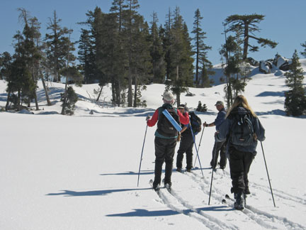
Skiing across Flora Lake to low rise that overlooks Donner Lake
Regardless of the route you choose, you are treated to the "cozy" beauty of the area; both Azalea and Flora lakes are located in extremely beautiful settings that include granite walls and steep slopes. The top of the small rise to the east of Flora Lake affords a wonderful view of Donner Lake, the interstate and the transcontinental railroad — a great place for lunch if the sounds of the cars and trucks on the interstate do not bother you. If they do, eat at one of the lakes.
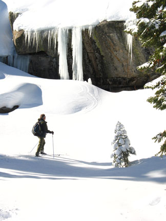
Ice formation on granite wall
Lake Angela is much larger and located in a barren setting that is marred only by the power lines that pass nearby. However, from this lake you have views south of Donner Peak, the ridge of which Mount Judah is a part, Mount Lincoln, and much more.
Exercise caution before skiing across the lakes described in this tour.
Mileage Log ![]()
Numbers in parentheses
correspond to mileage points on map
Waypoint 1 to 2
Miles: 0.0 - 0.4
Elevation change: +150 feet
From the trailhead (1) ski east and parallel to Donner Pass Road for a short distance until you pass under the power lines, and then ski north for 0.4 mile until you reach the dam at the south end of Angela Lake (2).
Waypoint 2 to 3
Miles: 0.4 - 1.1
Elevation change: +50, -50 feet
Ski north along Angela Lake and then pick the best route north around little obstacles for a total of 0.7 mile until you reach Flora Lake (3). Don't forget to visit the top of the rise to the east!

The terrain through this area can be amazingly beautiful when the light is just right
Waypoint 3 to 4
Miles: 1.1 - 1.4
Elevation change: Nil feet
Ski northwest for 0.3 mile until you reach Azalea Lake (4).
Return to trailhead
Miles: 1.4 - 2.8
Elevation change: +50, -200 feet
Retrace the route for 1.4 miles back to the trailhead (1).
