Summary ![]()
| Difficulty | 2 Beginner-intermediate |
| Length | 2.8 miles round trip |
| Starting Elevation |
7450 feet |
| Cumulative Elevation Change |
+300, -300 round trip |
| Navigation | Road and map |
| Time | Few hours |
| Season | December through April |
| Snowmobiles Use | Not permitted [Please report illegal use of snowmobiles in this area.] |
| USGS Topo | 7.5' series, Reading Peak |
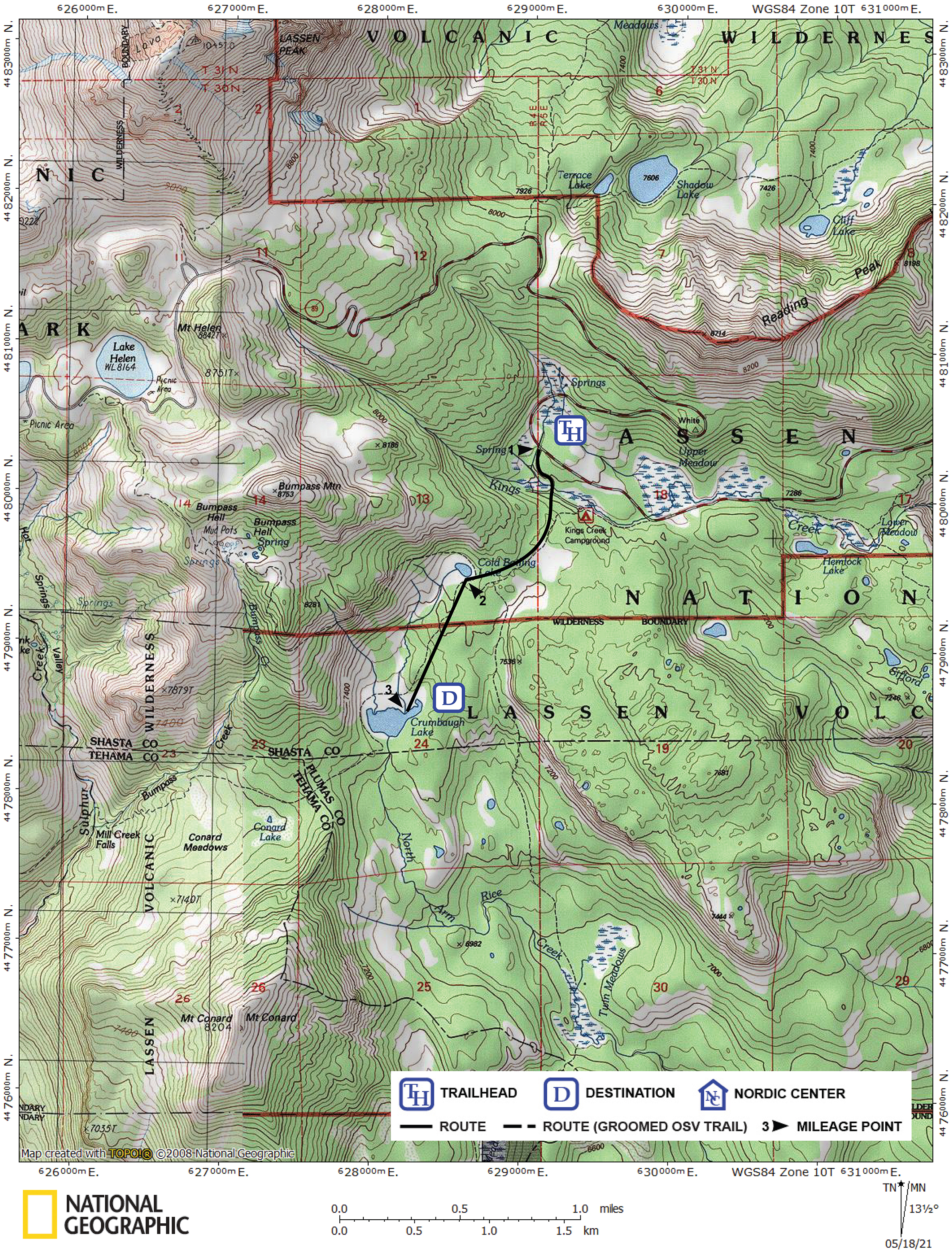
| Start | Snow-covered Lassen Park Road at the turnoff to Kings Creek Picnic Area, which is located 11.0 miles from the Kohm Yah-mah-nee Visitor Center. |
Description ![]()
Skiers visiting the heart of Lassen's backcountry will find the Kings Creek area an excellent place to camp. The possibilities for day tours from this base are countless, limited only by your imagination. Cold Boiling and Crumbaugh Lakes are two possibilities. The tour described here is a day trip from a basecamp here.
You can extend the tour beyond Crumbaugh Lake by continuing to Conard Lake and Meadows as described in the Conard Lake Loop tour. The Conard Lake Loop tour also describes an alternate route from Lake Helen to Cold Boiling and Crumbaugh Lakes which is useful to snow campers doing a day tour from Emerald Lake or Lake Helen.
Mileage Log ![]()
Numbers in parentheses
correspond to mileage points on map
Waypoint 1 to 2
Miles: 0.0 - 0.8
Elevation change: +50, -50
From the turnoff to Kings Creek Picnic Area (1) ski generally south and gradually turn west, skirting Bumpass Mountain's east ridge, for a total of 0.8 mile until you reach Cold Boiling Lake (2). You can follow the road toward the picnic area for the the first 0.2 mile.
Waypoint 2 to 3
Miles: 0.8 - 1.4
Elevation change: -200
Ski southwest for 0.6 mile until you reach Crumbaugh Lake (3). Do not ski beneath the steep southeast slopes of Bumpass Mountain when avalanche conditions exist.