Summary ![]()
| Difficulty | 4 Intermediate-advanced |
| Length | 1.4 miles one-way |
| Starting Elevation |
6700 feet |
| Cumulative Elevation Change |
+800 feet one-way (uphill direction) |
| Navigation | Road and marked trail |
| Time | Up to full day (based on combining with Gooseberry Road) |
| Season | December through mid-April |
| Snowmobiles Use | Not permitted [Please report illegal use of snowmobiles in this area.] |
| USGS Topo | 7.5' series, Pinecrest |
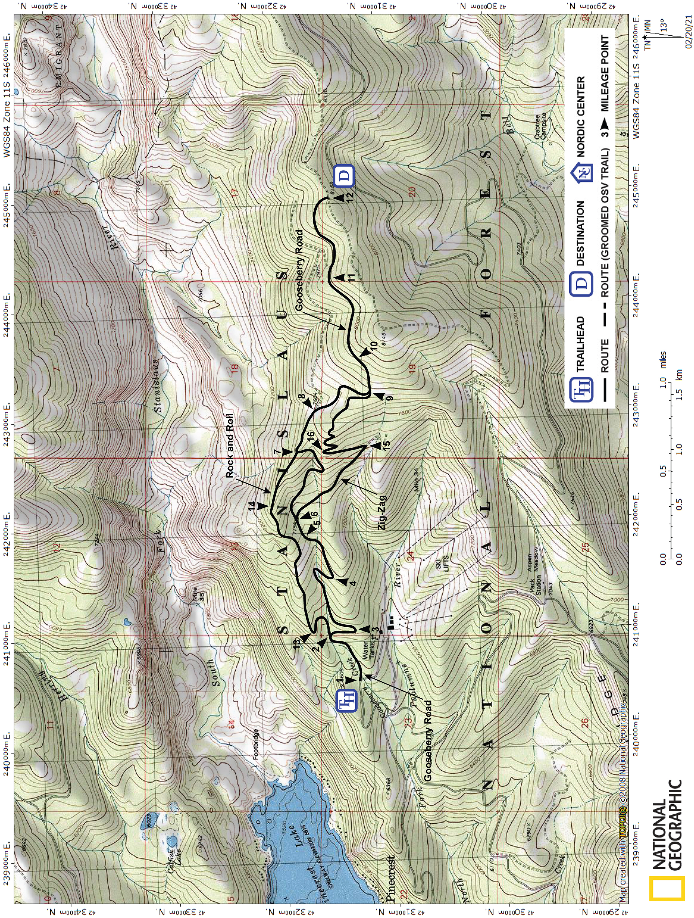
| Start | This is a bypass tour that connects mileage points 2 and 7 of the Gooseberry Road to Burst Rock Junction tour.
The Gooseberry Trailhead is located at the Dodge Ridge Ski Resort parking loop. Follow Dodge Ridge Road to the one-way loop of the ski area parking lot. Follow the loop to the ski area lodge and turn around as though leaving. From the lodge it is 0.3 mile to the Gooseberry Trailhead. The trailhead will be on the north (right) side of the road. |
Description ![]()
The Rock and Roll tour and the Zig-Zag tour bypass sections of the Gooseberry Road to Burst Rock Junction tour. You can mix sections of the Gooseberry Road, Rock and Roll, and Zig-Zag tours to create a custom tour with great variation. But be aware that Rock and Roll is more difficult than Gooseberry Road.
Unlike Gooseberry Road, except for a short section, Rock and Roll does not follow roads. Instead it traverses a ridge. Although it is possible to simply "follow the ridge", staying on the marked trail requires careful attention due to lots of little turns; anyone skiing fast down the ridge can easily loose the markers.
The Forest Service's map recommends skiing down Rock and Roll. Here it is described going up because (a) it is easier to follow the markers in this direction because you are going slower and (b) the narrow route is more difficult to ski downhill.
Mileage Log ![]()
Numbers in parentheses
correspond to mileage points on map
Note: The Pinecrest Nordic Ski Patrol has marked many backcountry ski trails in this area. Where applicable, the numbers and name of the trails are given in brackets. Visit their website to download a map showing all the marked trails or obtain a map at the Summit Ranger District office at #1 Pinecrest Lake Road near the junction with Highway 108.
Waypoint 2 to 13
Miles: 0.0 - 0.3
Elevation change: +100 feet
From a 180-degree turn in Gooseberry Road (2), which is located 0.3 mile from the Gooseberry Trailhead, leave the main road and follow a lessor road that is part of the Stanislaus Overlook tour in a counter-clockwise loop for 0.3 mile until you reach a sharp turn in the road and a broad ridge that crosses the road (13). [#13 Stanislaus]
Waypoint 13 to 14
Miles: 0.3 - 1.1
Elevation change: +550 feet
Leave the road and ski east at first and then northeast on a ridge for 0.8 mile until you reach a point where the ridge turns to the southeast and becomes a bit less steep (14). The ridge is broad at first but narrows as you approach the end of this section. [#14 Rock and Roll]
Waypoint 14 to 7
Miles: 1.1 - 1.4
Elevation change: +150 feet
Continue along the ridge to the southeast for 0.3 mile until your reach Gooseberry Road (7). [#14 Rock and Roll]