
Summary ![]()
| Difficulty | 3 Intermediate for two-day round trip 4 Intermediate-advanced for one-day round trip |
| Length | 11.0 miles round trip |
| Starting Elevation |
6500 feet |
| Cumulative Elevation Change |
+1300, -1300 feet |
| Navigation | Road, marked trail, map and compass |
| Time | Very long day or most of each of two days if staying overnight at the Bunkhouse |
| Season | Late December through early April |
| Snowmobiles Use | Not permitted [Please report illegal use of snowmobiles in this area.] |
| USGS Topo | 7.5' series, Loon Lake |
| Start | Junction of Ice House Road and snow-covered road to Loon Lake Campground. From Highway 50 turn north onto Ice House Road. Drive 24 miles to the intersection where you must turn right to stay on Ice House Road. Turn right and continue for 4.4 miles until you reach the snow-covered road to the Loon Lake Campground. This location is 0.9 mile before the Loon Lake Chalet. |
Description ![]()
The Van Vleck Bunkhouse, built in 1957, is nestled in a red fir forest on the edge of a meadow. The bunkhouse is all that remains of the Van Vleck Ranch site, which from the 1860's to the 1960's operated as a cattle ranch.

Van Vleck Bunkhouse in low snow year
The Bunkhouse, a facility operated by the Forest Service, sleeps eight people and can be reserved through Recreation.gov both winter and summer. Additional information is available from the Forest Service.
 Van Vleck Bunkhouse in good snow year
 The Bunkhouse is deluxe compared to other ski huts in the Sierra. It is outfitted with a propane oven and cook-top, propane heat and lights, and basic pots, pans and utensils. To top it off, there is running water and a flush toilet inside.
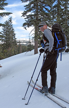
The tour to the Bunkhouse is a very rewarding experience for intermediate and advanced skiers alike. The terrain is varied with idyllic sections along tree lined roads, wide open areas and vistas of the Crystal Range. It can also offer navigational challenges if the visibility is poor.
The route, partly on snow-covered roads and partly cross-country, is well marked with blue diamonds and ribbons. However, don't let this lull you into a sense of ease! The route requires stamina and speed if you are skiing in and out in one day. Under poor weather conditions the flat area near the landing strip is difficult to navigate, sending more than one experienced skier off in the wrong direction for an unexpected and chilly bivouac.
Speed is less important if you stay overnight at the Bunkhouse, but then you must carry a heavier pack.
The Van Vleck Storm Shelter is located on route to the Bunkhouse at mile 2.4 and at the junction of the Van Vleck Bunkhouse and Shadow Lake tours (the tour to Shadow Lake has not been created yet — stay tuned). The storm shelter is essentially that — a place to get indoors in bad weather or spend the night in an emergency. For some people the shelter is a destination in itself.

Van Vleck Storm Shelter
Mileage Log ![]()
Numbers in parentheses
correspond to mileage points on map
Waypoint 1 to 2
Miles: 0.0 - 0.4
Elevation change: -50 feet
From the trailhead (1) ski northeast on the snow-covered road for 0.4 mile until you reach the sign marking the Van Vleck turnoff (2). This tour follows the trail that heads east from the sign to the Van Vleck Bunkhouse while other marked trails continue straight ahead.
Waypoint 2 to 3
Miles: 0.4 - 1.3
Elevation change: +150, -150 feet
Ski northeast and then southeast for a total of 0.9 mile until you reach a bridge (3) across the South Fork of the Rubicon River. The bridge is an old railroad flat car.
Following the marked route in this section makes navigation through the nondescript, tree-covered terrain much easier. If you didn't have the markers you would first travel northeast toward a small ridge (it looks like a knob from the direction you approach it) and then you would travel around the south side of the ridge and descend to the bridge.
Waypoint 3 to 4
Miles: 1.3 - 1.8
Elevation change: +300 feet
Ascend the slope to the southeast for 0.5 mile until you reach a landing (4). The landing is an obvious cleared, flat place.
Waypoint 4 to 5
Miles: 1.8 - 2.4
Elevation change: +200 feet
Ski east and then southwest on a snow-covered road for a total of 0.6 mile until you reach the Van Vleck Storm Shelter (5) at a road junction. The road to the east heads toward Shadow Lake and the road continuing south leads to the Van Vleck Bunkhouse.
Waypoint 5 to 6
Miles: 2.4 - 3.3
Elevation change: +50, -50 feet
Ski south on the snow-covered road for 0.9 mile, over the highpoint of the route, until you reach a small aspen grove (6). A landing strip is located 100 yards to the southeast over a very small rise. This section contours through corridors of trees and through flat, open areas. In can be difficult to follow the road in the open areas.

Aspen meadow
Waypoint 6 to 7
Miles: 3.3 - 3.9
Elevation change: -100 feet
Descend gently along the road to the south through a corridor of trees for 0.6 mile until you reach Milkhouse Meadow (7).
Waypoint 7 to 8
Miles: 3.9 - 4.3
Elevation change: -100 feet
Ski south on the road for a total of 0.4 mile until you reach the weather station (8) located on the east (left) side of the road.

Weather station
Waypoint 8 to 9
Miles: 4.3 - 4.6
Elevation change: -100 feet
Ski south and then west on the road for a total of 0.3 mile until you reach the northeast end of Timothy Meadow (9).
Waypoint 9 to 10
Miles: 4.6 - 5.1
Elevation change: -50 feet
Ski west on the road along the north side of Timothy Meadow and then into the trees for a total of 0.5 mile until you reach the east end of a meadow (10).
Waypoint 10 to 11
Miles: 5.1 - 5.5
Elevation change: Nil
Ski southwest through the meadow for 0.4 mile until you reach the Van Vleck Bunkhouse (11). The route through the meadow does not follow the road that loops around the northern arm of the meadow. Instead it crosses the north arm. Blue mega-diamonds are located on both sides to the arm.

Mega-diamond trail marker
Return to trailhead
Miles: 5.5 - 11.0
Elevation change: +600, -700 feet
Retrace the route for 5.6 miles back to the trailhead (1).
Alternate Routes
Two alternate routes are shown on the map for this tour.
Alternate Route 1
Alternate Route 1 connects Milkhouse Meadow with the meadow where Van Vleck Bunkhouse is located. You may want to use this route for one of a couple of reasons. It is an excellent alternative return route from the bunkhouse affording a change from the road skied to the bunkhouse. It can also be combined with the road to the bunkhouse to form an excursion during a layover at the bunkhouse.
The route is straight-forward to follow though you will need a map and maybe a compass. From the bunkhouse ski up the northern arm of the meadow in which Van Vleck Bunkhouse is located and then continue to ascend north to a saddle. You may encounter the old road that once passed through here. From the saddle ski around the west side of Peak 6949 and then east along its north side. Finally descend east into Milkhouse Meadow and continue to ski east to the road described in the main route to the bunkhouse. The view of Tells Peak as you round the north side of Peak 6949 is outstanding.
 Tells Peak from north side of Peak 6949
 Descending into Milkhouse Meadow from north side of Peak 6949
 Skiing through Milkhouse Meadow
Alternate Route 2
Alternate Route 2 is presented as an alternative to the descent from the Van Vleck Storm Shelter to the South Fork of the Rubicon River via the narrow road, which is often icy after trodden by skiers and snowshoers. It also offers skiers a wonderful opportunity to carve turns between scattered trees.
This route leaves the road a short distance north and below the Van Vleck Storm Shelter. Ski northwest and then north until you intersect the road once again a short distance south of the South Fork of the Rubicon River. If you are too far west you may miss intersecting the road and instead intersect the river in which case you must ski east to the bridge across the river.
