Summary ![]()
| Difficulty | 1 Beginner |
| Length | 2.1 miles round trip |
| Starting Elevation |
7050 feet |
| Cumulative Elevation Change |
+50, -50 round trip |
| Navigation | Map |
| Time | Several hours |
| Season | Mid-December through mid-April |
| Snowmobiles Use | Not permitted [Please report illegal use of snowmobiles in this area.] |
| USGS Topo | 7.5' series, Glenbrook |
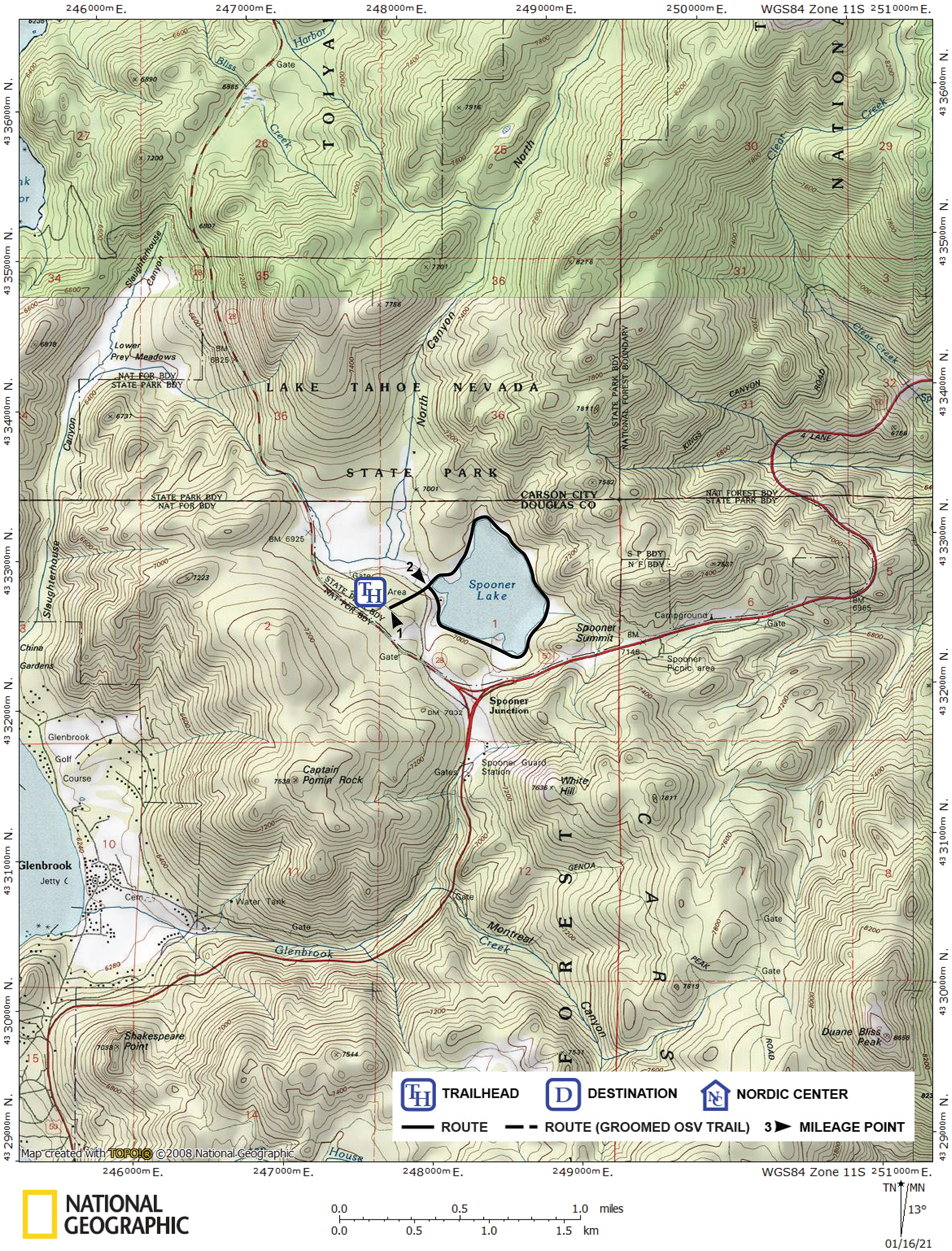
| Start | Lake Tahoe Nevada State Park on the east side of Highway 28, 0.7 mile north of Spooner Junction. After passing by the entrance station, keep right and park near the restroom. A fee is charged for parking. |
Description ![]()
This tour around Spooner Lake is adjacent to the North Canyon Creek tour, and beginners can easily ski both in one day. More advanced skiers may also enjoy this tour because it gives them the opportunity to kick up their heels or skate. The Spooner Lake area is a popular destination for locals and tourists alike.

Spooner Lake
The Spooner Lake area was open to the public in winter for the price of parking up until 1985. There were even markers denoting points along the trails (roads) in the area.
In 1985 Nevada State Parks gave a concession to Spooner Lake Cross Country to operate on the Spooner Lake park lands and it became a fee for use area. The concessionaire rented equipment, gave lessons and offered two beautiful Scandinavian style hand-hewn log cabins for rent.
But after 27 years of operation, Spooner Lake Cross Country is closed for the 2012-2013 winter season and there are no current plans to re-open. The cause of the closure was rising costs and uncertainty about snow conditions that the previous year resulted in only being open for 30 days.
As a result, beginning with the 2012-2013 winter season, the park is again open to the public for the price of parking.
Mileage Log ![]()
Numbers in parentheses
correspond to mileage points on map
Waypoint 1 to 2
Miles: 0.0 - 0.1
Elevation change: -50 feet
From the trailhead (1) ski northeast for 0.1 mile until you reach the southwest end of the dam (2). You will cross a road where the terrain levels before reaching the dam.
Waypoint 2 to 2
Miles: 0.1 - 2.0
Elevation change: Nil
Cross the dam to its north side and then proceed to ski 1.9 miles around the lake in a clockwise direction until you return to the dam (2). It is not safe to ski on the lake.
Return to trailhead
Miles: 2.0 - 2.1
Elevation change: +50 feet
Retrace the route for 0.1 mile back to the trailhead (1).