
Summary ![]()
| Difficulty | 3 Intermediate to Ginny Lake 4 Intermediate-advanced to ridge above lake |
| Length | 2.8 miles round trip to Ginny Lake 3.8 miles round trip to ridge above lake |
| Starting Elevation |
8550 feet |
| Cumulative Elevation Change |
+550, -550 round trip to Ginny Lake +1000, -1000 round trip to ridge above lake |
| Navigation | Map and compass |
| Time | Several hours |
| Season | Mid-December through April |
| Snowmobiles Use | Not permitted [Please report illegal use of snowmobiles in this area.] |
| USGS Topo | 7.5' series, Mount Rose |
| Start | Highway 431, 6.6 miles northeast of Highway 28 and 1.5 miles southwest of Mount Rose Summit. An area that looks like a small parking lot is located here though it is marked "no parking." |
Description ![]()
The best word that describes Ginny Lake is secluded. It's also a short tour with most of the 1.4 miles to the lake being quite level, but there is a modestly steep climb in one area.
At Ginny Lake your view is limited to the ridges that surround it. But a 0.4 mile extension to the south deposits you on a ridgetop with a grand view of Lake Tahoe below. This extension ups the intermediate tour to intermediate-advanced.

Adjacent to Ginny Lake; the extension of the tour ascends the ridge on the left

Lake Tahoe from the ridge above Ginny Lake
Mileage Log ![]()
Numbers in parentheses
correspond to mileage points on map
Waypoint 1 to 2
Miles: 0.0 - 0.4
Elevation change: -50 feet
From the trailhead (1) ski west on a snow-covered road for 0.4 mile until you reach the point where the road begins a sharp turn to the south (left) (2).
Waypoint 2 to 3
Miles: 0.4 - 0.5
Elevation change: +50 feet
Turn north (right) onto a lesser snow-covered road, and ski north and then west for a total of 0.1 mile until you reach Third Creek (3). The road disappears not far after you start this section.
Waypoint 3 to 4
Miles: 0.5 - 0.9
Elevation change: +50, -50 feet
Cross Third Creek, then ski west and then into a meadow area for a total of 0.4 mile until you reach the west end of the meadow area (4). Crossing Third Creek can be tricky; search out a good spot.
Waypoint 4 to 5
Miles: 0.9 - 1.4
Elevation change: +350 feet
Climb west and then ski level through a meadow area for a total of 0.5 mile until you reach Ginny Lake (5).

Climbing toward Ginny Lake
Return to trailhead
Miles: 1.4 - 2.8
Elevation change: -450, +100 feet
Retrace the route for 1.4 miles back to the trailhead (1). As an alternative you can extend the tour as described below.
Extension south to ridgetop
Waypoint 5 to 6
Miles: 1.4 - 1.9
Elevation change: +450 feet
Climb south for 0.5 mile until you reach a saddle and ridgetop (6).
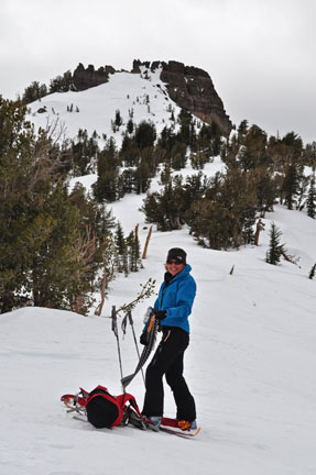
Shedding climbing skins after reaching ridgetop
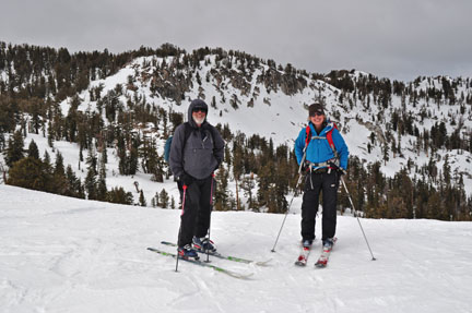
Friends sharing good times
Return to trailhead
Miles: 1.9 - 3.8
Elevation change: +100, -900 feet
Retrace the route for 1.9 miles back to the trailhead (1).
