
Summary ![]()
| Difficulty | 3 Intermediate |
| Length | 5.1 miles round trip |
| Starting Elevation |
8850 feet |
| Cumulative Elevation Change |
+900, -900 round trip |
| Navigation | Road and map |
| Time | Full day |
| Season | Mid-December through April |
| Snowmobiles Use | Not permitted on the mile of road closest to the highway nor anywhere in the off road part of the tour. Low elsewhere on road. [Please report illegal use of snowmobiles in this area.] |
| USGS Topo | 7.5' series, Mount Rose |
| Start | Highway 431, 7.8 miles northeast of Highway 28 and 0.3 mile southwest of Mt. Rose Summit. A building and snow-covered road are located on the north side of the highway. Parking is limited; as an alternative start the tour at the parking area located 0.4 mile to the west. |
Description ![]()
Circumnavigating Tamarack Peak may be the best all-around ski tour in the vicinity of Tahoe Meadows. The tour is divided 50-50 between off-road and on-road travel. The off-road part traverses the east and north sides of Tamarack Peak. The terrain is interesting and the expansive vistas outstanding. The views include Washoe Valley far down below and Mount Rose towering above. Here you will feel like you are in an area much more remote than it really is. The return to the starting point is along a less interesting snow-covered road but it affords fine views including Tahoe Meadows below, Lake Tahoe in the distance and snowcapped peaks beyond.

Washoe Valley in distance
A glance at the topographic map shows the route passing through terrain with lots of convolutions and following it may look a little dauntless. That's not the case if you follow two simple rules — keep Tamarack Peak on your left and follow a level course as much as possible from the saddle at waypoint 3 to the north side of Tamarack Peak at waypoint 5.
Mileage Log ![]()
Numbers in parentheses
correspond to mileage points on map
Waypoint 1 to 2
Miles: 0.0 - 0.3
Elevation change: +50 feet
From the trailhead (1) ski west on the snow-covered road for 0.3 mile until the terrain to the north (right) is open (2).
Waypoint 2 to 3
Miles: 0.3 - 0.5
Elevation change: +200 feet
Ascend north for 0.2 mile until you reach a broad saddle (3). Ski to the saddle's lowest point, the west end, if you reach the saddle elsewhere.
Waypoint 3 to 4
Miles: 0.5 - 1.1
Elevation change: +150,-100 feet
Traverse north for 0.6 mile until you reach another broad saddle (4) located between Tamarack Peak and a rocky ridge of which Peak 9282 is a part.

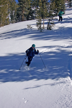
Traversing through trees between two saddles
Waypoint 4 to 5
Miles: 1.1 - 1.8
Elevation change: +100, -200 feet
Traverse northwest for 0.7 mile until you reach a small spur ridge (5) on the north side of Tamarack Peak.
Short, sweet downhill run
Waypoint 5 to 6
Miles: 1.8 - 2.7
Elevation change: +400, -50 feet
Ski west and then south for a total of 0.9 mile until you reach a very, very broad saddle and intersect Relay Road (6). Three-tenths mile into this section you are faced with a very steep but short climb. Pick the best route you can find. You can also ski north to Galena Creek to get around this section if necessary. Beyond the steep climb you are treated to a gradual climb through a beautiful meadow area to the road.

Skiing up Galena drainage toward Relay Road
Waypoint 6 to 1
Miles: 2.7 - 5.1
Elevation change: -550 feet
Turn south (left) onto Relay Road and follow it, eventually turning east, for a total of 2.4 miles until you reach the trailhead (1).
