
Summary ![]()
| Difficulty | 4 Intermediate-advanced |
| Length | 10.0 miles round trip |
| Starting Elevation |
7100 feet |
| Cumulative Elevation Change |
+2400, -2400 round trip |
| Navigation | Map and compass |
| Time | Very long day or two shorter days if staying in hut |
| Season | January through mid-April |
| Snowmobiles Use | Low |
| USGS Topo | 7.5' series, Norden |
| Start | Sugar Bowl Academy (formerly the home of Alpine Skills Institute), 3.9 miles east of Interstate 80 and 0.2 mile east of Donner Ski Ranch on Donner Pass Road. For day trips, people often park at Donner Ski Ranch and walk east on Donner Pass Road to the start of the tour at the Academy. Do not park there overnight. One option is to drop people and gear off at the trailhead, park at the Sierra Club's Clair Tappaan Lodge, and the driver hitch a ride back to the starting point. An alternative starting point is the Mt. Judah Lodge at Sugar Bowl Ski Resort, 0.9 mile south of Donner Ski Ranch and Donner Pass Road. |
Description ![]()
The route to the Sierra Club's Benson Hut begins with a not so much fun trek through Sugar Bowl Ski Area. But once you reach Roller Pass, and heading toward the summit of Mt. Lincoln, the scenery explodes with breathtaking views. Although you can look north to majestic Castle Peak, the really awesome sight is the ridge running between Mt. Lincoln and Anderson Peak with Anderson Peak and Tinker Knob dominating the view.
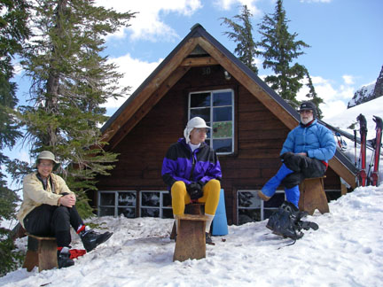
Benson Hut. Courtesy of Vic Taugher.

Castle Peak

Along ridge with Anderson Peak in upper right
Beyond Mt. Lincoln the route follows a windswept ridge, often bare in places, to the north spur of Anderson Peak. Benson Hut is located on the spur near its base.
Benson Hut is both a destination in its own right and an intermediary point on three longer tours described in this guide.
- Sugar Bowl to Palisades Tahoe
- Benson and Bradley Huts Via Tinker Knob (coming soon)
- Benson and Bradley Huts Via Emergency Escape Route
Benson Hut is small and rustic, but offers heart-warming shelter from the winds that often scour this area. The hut can be near entirely covered by snow in a good winter.

Benson Hut. Courtesy of Vic Taugher.

Downstairs in Benson Hut. Courtesy of Curtis Oldenburg.

Downstairs in Benson Hut. Courtesy of Curtis Oldenburg.
The round trip elevation change is +2400, -2400 feet, but if you turn it into a two-day tour, going to the hut it is +1850, -550 feet and returning it is +550, -1850 feet.
Make reservations to stay overnight at this Sierra Club hut by contacting:
Clair Tappaan Lodge
P.O. Box 36
Norden, CA 95724
530-426-3632 (phone)
800-679-6775 (toll free)
530-426-0742 (fax)
ctl@sierraclub.org
You do not have to be a member of the Sierra Club to use this hut. As one might expect, however, reservations for weekends and holidays are difficult to obtain. Volunteer for a summer or fall work party at one of the Sierra Club's huts to get reservation priority (contact Clair Tappaan Lodge for more information).
The traditional start point for this tour is where the Pacific Crest Trail crosses Donner Pass Road at the Sugar Bowl Academy (formerly the home of Alpine Skills Institute). An alternative start point is the Mt. Judah Lodge at Sugar Bowl Ski Resort. The lodge is 100 feet lower than the traditional start point, but this route saves 0.8 mile in each direction.
Unfortunately Sugar Bowl Ski Resort charges for crossing their property (both private and leased) if you start at the Mt. Judah Lodge; you need to purchase an "uphill pass." You can also purchase a one-way lift ticket to the top of Mt. Lincoln.
Be aware that the route that begins from the traditional start point crosses Sugar Bowl Ski Resort leased lands, but you have the right to travel this route without paying. You can thank Snowlands Network for protecting this free access.
Regardless of the route you choose, you will encounter many groomed ski slopes. You should avoid these slopes where possible and exercise caution when crossing them.
Mileage Log ![]()
Numbers in parentheses
correspond to mileage points on map
Waypoint 1 to 2
Miles: 0.0 - 0.2
Elevation change: -50 feet
Locate the snow-covered road 50 feet west of the Sugar Bowl Academy parking lot (1) and follow it south for 0.2 mile until you reach the location where the road turns west (right) (2).
Waypoint 2 to 4
Miles: 0.2 - 2.0
Elevation change: +900 feet
Ski south for 1.4 miles and then southeast for 0.4 miles until you reach a point on the ridge just southwest of Roller Pass (4).
Alternate route from the Mt. Judah Lodge
Waypoint 7 to 4
Miles: 0.0 - 1.2
Elevation change: +950 feet
From the base of the Jerome Hill Express ski lift (7), climb southeast for 0.4 mile to mileage point 3, then south for 0.5 mile, and finally southeast for 0.3 mile until you reach a point on the ridge just southwest of Roller Pass (4). This route adds 50 feet of elevation gain and reduces the length of the tour by 0.8 mile.
Continuing on the traditional route
Waypoint 4 to 5
Miles: 2.0 - 2.2
Elevation change: +250 feet
Climb southwest on the ridge toward Mt. Lincoln for 0.2 mile until you reach a point where you can safely traverse south to the southeast ridge of Mt. Lincoln (5). You should climb higher than shown on the map if you are in doubt about the avalanche danger on the east slope of Mt. Lincoln.

Ridge running from Mt. Lincoln (off photo to right) to Anderson Peak. Courtesy of Vic Taugher.
Waypoint 5 to 6
Miles: 2.2 - 5.0
Elevation change: +700, -500 feet
Traverse to the south and then ski southeast along a ridge for a total of 2.8 miles until you reach Benson Hut (6). The best route is usually along the very top of the ridge except for where you pass to the southwest of Peak 8374. Be aware that the lee side of the ridge between Mt. Lincoln and Anderson Peak is littered with cornices; be sure to stay sufficiently away from these.
The net elevation gain in this section is only 200 feet, but along it you will climb 900 feet.

Skiing along corniced ridge with Mt. Lincoln in background. Courtesy of Vic Taugher.

Cornices on ridge. Courtesy of Vic Taugher.
Return to trailhead
Miles: 5.0 - 10.0
Elevation change: +550, -1850 feet
Retrace the route for 5.0 miles back to the Sugar Bowl Academy parking lot (1).
