Summary ![]()
| Difficulty | 3 Intermediate |
| Length | 4.2 miles round trip |
| Starting Elevation |
5750 feet |
| Cumulative Elevation Change |
+800, -800 round trip |
| Navigation | Road and map |
| Time | Half day |
| Season | Late December through early April |
| Snowmobiles Use | Low (see description for more details) |
| USGS Topo | 7.5' series, Cisco Grove |
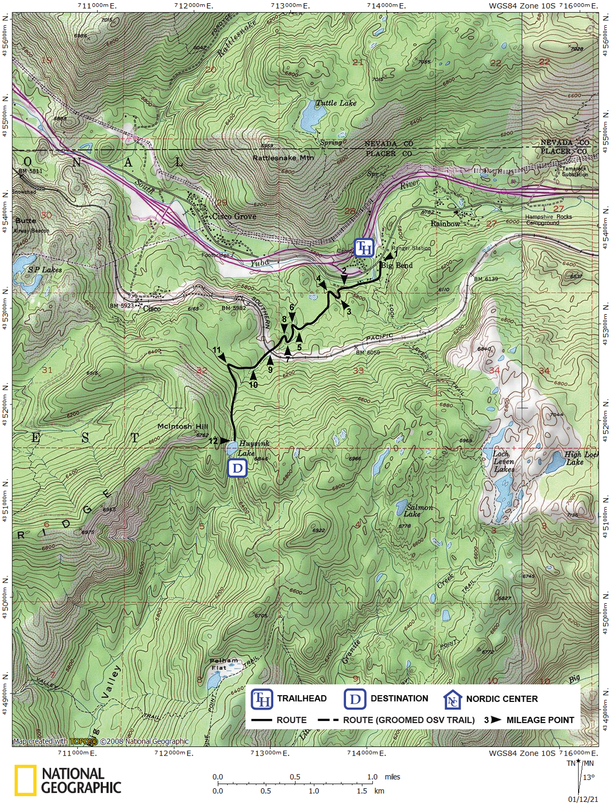
| Start | Small, snow-covered road on the south side of Hampshire Rocks Road (old Highway 40 or Donner Pass Road) and 0.1 mile west of the Big Bend Ranger Station (closed in winter). From eastbound Interstate 80, take Big Bend exit, turn east (left) onto Hampshire Rocks Road, and drive 0.15 mile to the trailhead. From westbound Interstate 80, take Big Bend/Rainbow Road exit, turn left and go under the highway, turn right onto Hampshire Rocks Road, and drive 1.2 miles to the trailhead. Be aware that there is no well-defined parking place. In spring you will find parking nearby along the highway. Other times you will have to search for a legal place to park. |
Description ![]()
Huysink Lake is unusual in that it lies on a mountain pass. A first glance at a topographic map will not entice you to visit here — the terrain looks steep and confined in a small drainage, and while it is, a road makes access relatively straight-forward.
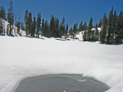
Huysink Lake
But don't be mislead by the road; following it takes considerable care because it makes numerous sharp turns that are easily missed. Also, while the average gradient is well within the limits of an intermediate tour, the final half-mile is steeper. The return descent can be difficult when snow-conditions are poor because there is limited room to maneuver.
Once at Huysink Lake the 0.9 mile extension to Peak 6966 is almost a must. This makes the tour to the lake more than worth the effort.
Snowmobile use in this area is low in terms of overall numbers, but cabin owners near the start often track the road. Fortunately a late March or early April tour will allow you to avoid the machines and enjoy the best snow conditions the Sierra has to offer. Why is this so? Because at least one creek cuts across the access road during the spring melt and forms a barrier to snowmobile travel. Of course this will require you to take off your skis and cross.

During spring creeks open up along the route
Keep in mind that while spring-time brings the consolidation of the snowpack and the melt-freeze cycle creates wonderful corn-snow, this tour is entirely on north-facing slopes and begins at only 5750 feet elevation. Be sure to pick a fair-weather spring day when you know that the snow will thaw for your return descent. Mid-winter the best time is after a cold storm when the snow remains soft.
Mileage Log ![]()
Numbers in parentheses
correspond to mileage points on map
Waypoint 1 to 2
Miles: 0.0 - 0.4
Elevation change: Nil
From the trailhead (1) ski south and then west on a snow-covered road for a total of 0.4 mile until you reach an obscure road junction (2).
Waypoint 2 to 9
Miles: 0.4 - 1.2
Elevation change: +250 feet
Take the south (left) road and follow its convoluted path to the southwest for 0.8 mile until you reach the railroad tracks (9). Waypoints 3 through 8 are additional waypoints provided for this section.

Route climbs steadily along road that is narrow at times
Waypoint 9 to 11
Miles: 1.2 - 1.6
Elevation change: +200 feet
Take off your skis and cross the railroad tracks. Be aware that in heavy snow years the banks on both sides of the tracks can be difficult to negotiate. You may find a shovel useful.
It goes without saying that you should exercise extreme caution when crossing the railroad tracks — use both your eyes and ears.
After crossing the tracks, continue skiing southwest and then west on the snow-covered road for a total of 0.4 mile until you reach a sharp turn in the road (11). Waypoint 10 is an additional waypoint provided for this section.
Waypoint 11 to 12
Miles: 1.6 - 2.1
Elevation change: +300, -50 feet
Continue south on the snow-covered road for 0.5 mile until you reach Huysink Lake (12) located in a saddle. You can see the saddle as you approach the highest point of the tour a short distance before the lake.
Return to trailhead
Miles: 2.1 - 4.2
Elevation change: +50, -750 feet
Retrace the route for 2.1 miles back to the trailhead (1).